


No ads even in the free version!
Perfect for hiking, riding, cycling, running, skiing or orienteering
Premium topo mapsUse in-app purchases to subscribe to high-quality, special-purpose maps. Flexible offline mode and competitive pricing.• OS OpenData (GB)• IGN TOP25, TOP50, Cadastre, Satellite and Littoral (marine maps) (FR) http://www.frogsparks.com/mytrails/ign/• Tour & Trail (Alpujarras, Axarquia, Costa Blanca, La Gomera, Lanzarote, La Palma, Madeira, Mallorca, Menorca, Sierra de Aracena, Tenerife)
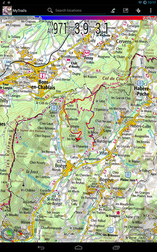
Full-screen trail map oriented with the built-in compass and GPSKnow exactly which direction you are going.Uncluttered map area, with unobtrusive controls and a traditional scale with track duration and distance.
OpenGL RenderingHardware-accelerated map drawing allows smooth and snappy display even with tens of thousands of track points.
Free online mapsPick from many built-in online map sources (OpenStreetMap, Yahoo, Bing, Google and many other global and local providers).Add more map sources using the configurable map sources (URL or WMS).Only premium maps are guaranteed: we may be forced to remove access to any of the other maps if requested by the rights-holders; this is regardless of whether you are using the Pro or Free version.
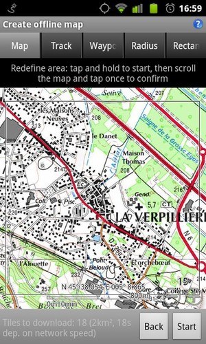
Offline mapsSave battery and data charges.The map displays instantaneously.Optionally falls back to online for non-covered areas.
Offline map creationNo need to use desktop-based tools to create offline maps, you can do it in MyTrails, in the background.Pause and resume the tile download.Download on WiFi only to save data charges.
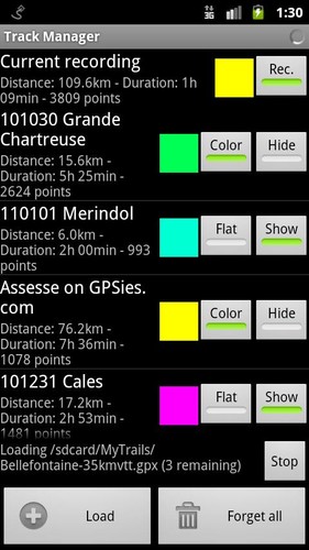
Record GPS tracksVisualize your track at any time and analyse your course during or after the outdoor activity.
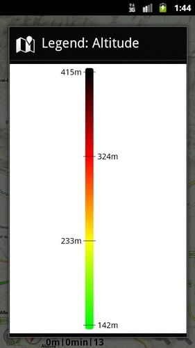
Display multiple colorized GPS tracks at onceVisualize your previous outings and those uploaded to GPS community sites, so that you always pick a great trail.Visualize the key indicators of the track (altitude, speed, rate of ascent, slope, GPS accuracy, etc.) right on the map with a detailed legend.
DirectionsGet visual directions from point A to point B.Vibrate, ring or spoken proximity notifications warn you of upcoming maneuvers.
WaypointsManually add waypoints to indicate memorable spots or upcoming turns.Waypoints are automatically generated when getting directions or when you take a break.
Share and archive tracksShare your tracks on My Trails, GPSies, UtagawaVTT and la-trace.com.Download tracks shared by other users in your vicinity.
GesturesEasily switch between active maps by swiping three fingers left to right in the map view.Pull down the HUD with information on your speed and altitude by swiping three fingers down your screen.
Full tablet supportPlan your outing on a large-screen tablet, go out and have fun, and when you're back, view the track in full glory. Use Dropbox to seamlessly synchronize between devices.
FAQ: http://www.frogsparks.com/wordpress/category/faq/
Permissions: please see the FAQ